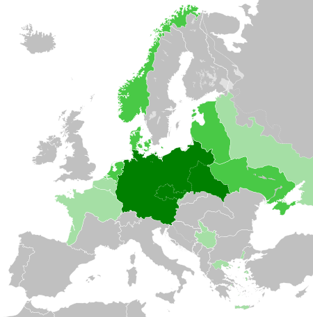
Ta'ãnga:Greater German Reich (1942).svg

Tamaño de esta previsualización PNG del archivo SVG: 450 × 456 píxeles. Otras resoluciones: 237 × 240 píxeles | 474 × 480 píxeles | 758 × 768 píxeles | 1011 × 1024 píxeles | 2021 × 2048 píxeles.
Marandurenda moambue'ỹre (archivo SVG, nominalmente 450 × 456 píxeles, tamaño de archivo: 594 kB)


.svg)
.svg)
.svg)
.svg)
.svg)


.svg)
.svg)
.svg)


.png)
.png)


.svg)


.svg)

.svg)


.svg)
.svg)
.svg)
.svg)


.svg)
.png)


.svg)


.svg)
.svg)


.svg)


.svg)


.svg)
.svg)
.svg)
.svg)
.svg)
.svg)
.svg)
.svg)
_cropped.svg)
.svg)
.svg)
.svg)
.svg)
.svg)
.svg)
.svg)
.svg)
.svg)
.svg)
.svg)
.svg)
.svg)
.svg)
.svg)
.svg)
.svg)
.svg)
.svg)
.svg)
.svg)
.svg)
.svg)
.svg)
.svg)
.svg)
.svg)
.svg)
.svg)
.svg)
.svg)
.svg)
.svg)
.svg)
.svg)
.svg)
.svg)
.svg)
.svg)
.svg)
.svg)
.svg)
.svg)
.svg)
.svg)
Marandurenda rembiasakue
Ejopy peteĩ ára/aravo rehe rehecha hag̃ua pe marandurenda ojehechaukaháicha upe jave.
.svg&dir=prev)
.svg&offset=20180422235102)
.svg&offset=&limit=20)
.svg&offset=&limit=50)
.svg&offset=&limit=100)
.svg&offset=&limit=250)
.svg&offset=&limit=500)
| Ára/Aravo | Michĩháicha | Tuichakue | Puruhára | Jehaimombyky | |
|---|---|---|---|---|---|
| ko’ag̃agua | 20:48 20 jasyapy 2023 | | 450 × 456 (594 kB) | Qbox673 | Reverted to version as of 07:51, 23 August 2020 (UTC) Please establish consensus on the talk page before changing. |
| 19:16 19 jasyapy 2023 |  | 450 × 456 (1,51 MB) | Daniilnihuya | Reverted to version as of 18:47, 22 August 2020 (UTC) | |
| 07:51 23 jasypoapy 2020 |  | 450 × 456 (594 kB) | BOS2077 | Reverted to version as of 13:23, 28 July 2020 (UTC) | |
| 18:47 22 jasypoapy 2020 |  | 450 × 456 (1,51 MB) | Terryfirut | Reverted to version as of 17:17, 5 July 2020 (UTC) | |
| 13:23 28 jasypokõi 2020 |  | 450 × 456 (594 kB) | Staberinde | Reverted to version as of 01:04, 24 April 2018 (UTC) restore old version, puppet states are not the same thing as occupied territory | |
| 04:12 7 jasypokõi 2020 |  | 450 × 456 (1,04 MB) | Croatianpotato | Reverted to version as of 22:35, 4 July 2020 (UTC) | |
| 17:17 5 jasypokõi 2020 |  | 450 × 456 (1,51 MB) | Hell - lllio | Winter Offensive Occupied Territory | |
| 22:35 4 jasypokõi 2020 |  | 450 × 456 (1,04 MB) | Hell - lllio | Vichy France (and its colonies) and Slovakia we're German Puppet States, so it should be Included in the Civilian Controlled Occupied Territories (Puppets) | |
| 01:04 24 jasyrundy 2018 |  | 450 × 456 (594 kB) | TRAJAN 117 | +++ | |
| 23:51 22 jasyrundy 2018 |  | 450 × 456 (594 kB) | TRAJAN 117 | +++ |
Marandurenda jeporu
La siguiente página usa este archivo:
Marandurenda jepuru opaite tembiapópe
Ko'ã ambue wiki oipuru ko marandurenda:
- Jeporu ar.wikipedia.org rehe
- Jeporu av.wikipedia.org rehe
- Jeporu az.wikipedia.org rehe
- Jeporu bbc.wikipedia.org rehe
- Jeporu bg.wikipedia.org rehe
- Jeporu cs.wikipedia.org rehe
- Jeporu el.wikipedia.org rehe
- Jeporu en.wikipedia.org rehe
- Jeporu es.wikipedia.org rehe
- Jeporu fr.wikipedia.org rehe
- Jeporu he.wikipedia.org rehe
- Jeporu hr.wikipedia.org rehe
- Jeporu hu.wikipedia.org rehe
- Jeporu id.wikipedia.org rehe
- Jerman Nazi
- Daftar imperium terbesar
- Anschluss
- Wikipedia:Artikel pilihan/Jadwal/Usulan/2020
- Wikipedia:Artikel pilihan/Jadwal/Usulan/2020/Periode 3
- Wikipedia:Artikel pilihan/Jadwal/Usulan/2020/Periode 8
- Wikipedia:Artikel pilihan/Daftar artikel pilihan 2020
- Wikipedia:Artikel Pilihan/32 2020
- Wikipedia:Arsip halaman utama/2020/08/03
- Wikipedia:Arsip halaman utama/2020/08/04
- Wikipedia:Arsip halaman utama/2020/08/05
- Wikipedia:Arsip halaman utama/2020/08/06
- Wikipedia:Arsip halaman utama/2020/08/07
- Wikipedia:Arsip halaman utama/2020/08/08
- Wikipedia:Arsip halaman utama/2020/08/09
- Wikipedia:Artikel pilihan/Daftar artikel pilihan 2023
- Wikipedia:Artikel pilihan/Jadwal/Usulan/2023
- Wikipedia:Artikel pilihan/Jadwal/Usulan/2023/Periode 2
Ver más uso global de este archivo.
.svg)
.svg)