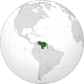
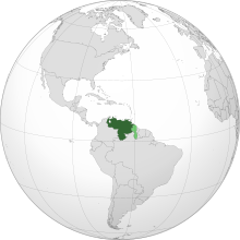
Ta'ãnga:VEN orthographic.svg

Tamaño de esta previsualización PNG del archivo SVG: 600 × 600 píxeles. Otras resoluciones: 240 × 240 píxeles | 480 × 480 píxeles | 768 × 768 píxeles | 1024 × 1024 píxeles | 2048 × 2048 píxeles | 792 × 792 píxeles.
Marandurenda moambue'ỹre (archivo SVG, nominalmente 792 × 792 píxeles, tamaño de archivo: 2,56 MB)
Marandurenda rembiasakue
Ejopy peteĩ ára/aravo rehe rehecha hag̃ua pe marandurenda ojehechaukaháicha upe jave.
| Ára/Aravo | Michĩháicha | Tuichakue | Puruhára | Jehaimombyky | |
|---|---|---|---|---|---|
| ko’ag̃agua | 21:33 17 jasyporundy 2021 |  | 792 × 792 (2,56 MB) | Magog the Ogre | restored pre-edit war version; please create another if you disagree |
| 12:23 11 jasyporundy 2021 |  | 550 × 550 (1,16 MB) | IuioPe | Reverted to version as of 20:02, 4 August 2021 (UTC) | |
| 06:14 7 jasypoapy 2021 |  | 792 × 792 (2,56 MB) | Ellywa | Reverted to first version | |
| 20:02 4 jasypoapy 2021 |  | 550 × 550 (1,16 MB) | El informante2021 | Reverted to version as of 09:27, 6 August 2012 (UTC) | |
| 12:36 4 jasypoapy 2021 |  | 792 × 792 (2,56 MB) | -sasha- | Reverted to version as of 12:47, 30 July 2021 (UTC) Insisto, usa File:Venezuela Orthographic Map.svg para mostrar la reclamación en el Esequibo. | |
| 03:50 31 jasypokõi 2021 |  | 550 × 550 (1,16 MB) | El informante2021 | Reverted to version as of 08:25, 16 July 2021 (UTC) Según el Acuerdo de Ginebra de 1966 el territorio en disputa se puede señalar como una zona en reclamación, él no hacerlo representa una violación a este Acuerdo. No se puede quitar la zona en reclamación, debido a que es una reclamación aceptada por las Naciones Unidas. | |
| 12:47 30 jasypokõi 2021 |  | 792 × 792 (2,56 MB) | -sasha- | Reverted to version as of 22:47, 14 July 2021 (UTC) As I said, there's another map if you need to show the disputed territory. | |
| 08:25 16 jasypokõi 2021 |  | 550 × 550 (1,16 MB) | El informante2021 | Reverted to version as of 12:11, 11 April 2021 (UTC) | |
| 22:47 14 jasypokõi 2021 |  | 792 × 792 (2,56 MB) | -sasha- | Reverted to version as of 01:12, 4 April 2021 (UTC) See discussion, use File:Venezuela Orthographic Map.svg if you need to show the disputed territory | |
| 12:11 11 jasyrundy 2021 |  | 550 × 550 (1,16 MB) | El informante2021 | 17:06, 15 de septiembre de 2020 |
Marandurenda jeporu
La siguiente página usa este archivo:
Marandurenda jepuru opaite tembiapópe
Ko'ã ambue wiki oipuru ko marandurenda:
- Jeporu ang.wikipedia.org rehe
- Jeporu arc.wikipedia.org rehe
- Jeporu ar.wikipedia.org rehe
- فنزويلا
- بوابة:فنزويلا
- بوابة:فنزويلا/واجهة
- مستخدم:جار الله/قائمة صور مقالات العلاقات الثنائية
- معاملة المثليين في فنزويلا
- العلاقات الأمريكية الفنزويلية
- العلاقات الأنغولية الفنزويلية
- العلاقات الفنزويلية الكورية الجنوبية
- العلاقات الإريترية الفنزويلية
- العلاقات السويسرية الفنزويلية
- العلاقات الألمانية الفنزويلية
- العلاقات الفنزويلية الليختنشتانية
- العلاقات البوليفية الفنزويلية
- العلاقات الفنزويلية الموزمبيقية
- العلاقات الألبانية الفنزويلية
- العلاقات البلجيكية الفنزويلية
- العلاقات الإثيوبية الفنزويلية
- العلاقات البيلاروسية الفنزويلية
- العلاقات الطاجيكستانية الفنزويلية
- العلاقات الروسية الفنزويلية
- العلاقات الرومانية الفنزويلية
- العلاقات الأرجنتينية الفنزويلية
- العلاقات الغامبية الفنزويلية
- العلاقات الفنزويلية القبرصية
- العلاقات السيراليونية الفنزويلية
- العلاقات الفنزويلية النيبالية
- العلاقات الفنزويلية الليبيرية
- العلاقات التشيكية الفنزويلية
- العلاقات الفنزويلية الميانمارية
- العلاقات السعودية الفنزويلية
- العلاقات الفنزويلية الكندية
- العلاقات الزيمبابوية الفنزويلية
- العلاقات البالاوية الفنزويلية
- العلاقات الفنزويلية المالية
- العلاقات الفنزويلية النيجيرية
- العلاقات اليمنية الفنزويلية
- العلاقات الفانواتية الفنزويلية
- العلاقات الغابونية الفنزويلية
- العلاقات البنمية الفنزويلية
- العلاقات الفنزويلية الكوبية
- العلاقات الجورجية الفنزويلية
- العلاقات التونسية الفنزويلية
- العلاقات الفنزويلية الكورية الشمالية
- العلاقات الهندية الفنزويلية
- العلاقات الإيطالية الفنزويلية
- العلاقات الفنزويلية الناوروية
- العلاقات الأسترالية الفنزويلية
- العلاقات الزامبية الفنزويلية
Ver más uso global de este archivo.


